Mapping Existing Canopy Coverage
- Jul 24, 2025
- 1 min read
Updated: Jan 5
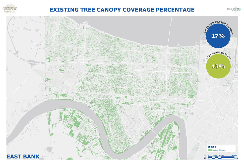
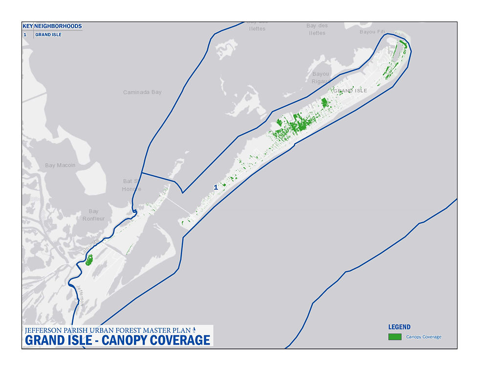
Friends of Jefferson the Beautiful worked with Dana Brown & Associates, Inc. to create the Jefferson Parish Urban Forest Master Plan. One major goal of the project is to find out where more trees are needed and where planting them would be most beneficial. First, they used high-quality aerial photos and a special tree-mapping tool called i-Tree, made by the U.S. Forest Service, to map the trees already in the parish. To make the process easier, Jefferson Parish was split into four geographic areas:
• East Bank
• West Bank
• Grand Isle
The images below show (in green) the tree canopy coverage in each of the three geographic areas.

The images below show (in green) the tree canopy coverage in each council district of Jefferson Parish. Each council district is color coded and the percentage of tree canopy coverage in each council district is shown in color coded circles on each image. Each percentage includes only East Bank or West Bank tree canopy areas.


Comments